Log in
All resources
Create a design
4,774 Free Images of Atlas Map
joan blaeu
copper engraving print
british library
1667 maps
atlas van loon
gemeente atlas van nederland - north holland
1860s maps of north holland
atlas maior, vol 9 (italy) - joan blaeu, 1667 - bl 114.h(star).9
1667 maps of italy
maps by willem and johannes blaeu
maps from university of amsterdam special collections
atlas der neederlanden
gemeente atlas van nederland - north holland
old maps of haarlem
atlas maior, vol 11 (asia) - joan blaeu, 1667 - bl 114.h(star).11
1667 maps
atlas maior, vol 10 (spain and africa) - joan blaeu, 1667 - bl 114.h(star).10
1667 maps
atlas maior, vol 10 (spain and africa) - joan blaeu, 1667 - bl 114.h(star).10
1667 maps
atlas maior, vol 9 (italy) - joan blaeu, 1667 - bl 114.h(star).9
1667 maps of italy
atlas maior, vol 4 (netherlands) - joan blaeu, 1667 - bl 114.h(star).4
1667 maps
atlas maior, vol 6 (scotland and ireland) - joan blaeu, 1667 - bl 114.h(star).6
1667 maps
maps of paris from the barry lawrence ruderman antique maps inc.
plan de turgot
maps by thomas kitchin
andrew dury
1790s maps of central america
1790s maps of cuba
17th-century maps of crimea
1640s maps of ukraine
maps from university of amsterdam special collections
atlas der neederlanden
maps from university of amsterdam special collections
atlas der neederlanden
grosser deutscher atlas
1794 maps of europe
grosser deutscher atlas
old maps of switzerland
atlas van loon
festung jülich
maps of utrecht (city) city walls
old maps of utrecht (city)
maps by willem and johannes blaeu
atlas van loon
maps of the history of palestine
1880s maps of palestine
coats of arms on maps
ships on maps
atlas maior, vol 2 (sweden, russia, poland, eastern europe, and greece) - joan blaeu, 1667 - bl 114.h(star).2
1667 maps of russia
atlas maior, vol 1 (northern europe, norway, and denmark) - joan blaeu, 1667 - bl 114.h(star).1
1667 maps
atlas minor gerardi mercatoris (1621, maps)
maps of china by mercator-hondius
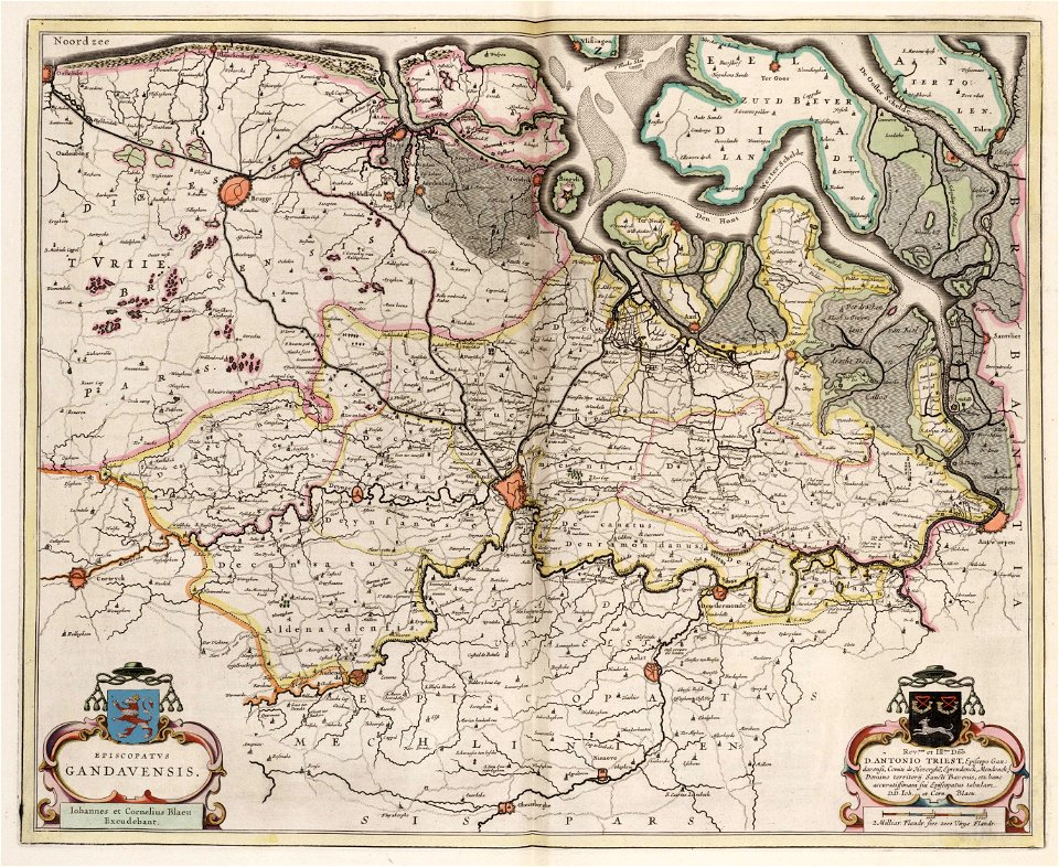
old maps of ghent
atlas van loon
miniature speed atlas (1627) pieter van den keere
old county maps of huntingdonshire
miniature speed atlas (1627) pieter van den keere
old county maps of gloucestershire
miniature speed atlas (1627) pieter van den keere
old county maps of leicestershire
miniature speed atlas (1627) pieter van den keere
old maps of the hebrides
miniature speed atlas (1627) pieter van den keere
old county maps of derbyshire
gemeente atlas van nederland - utrecht
old maps of amersfoort
media from regionaal archief alkmaar
oudkarspel
gemeente atlas van nederland - north holland
maps of kwadijk
maps made in the 17th century
old maps of sicily
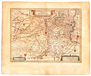
old maps of prince-bishopric of paderborn
johannes gigas
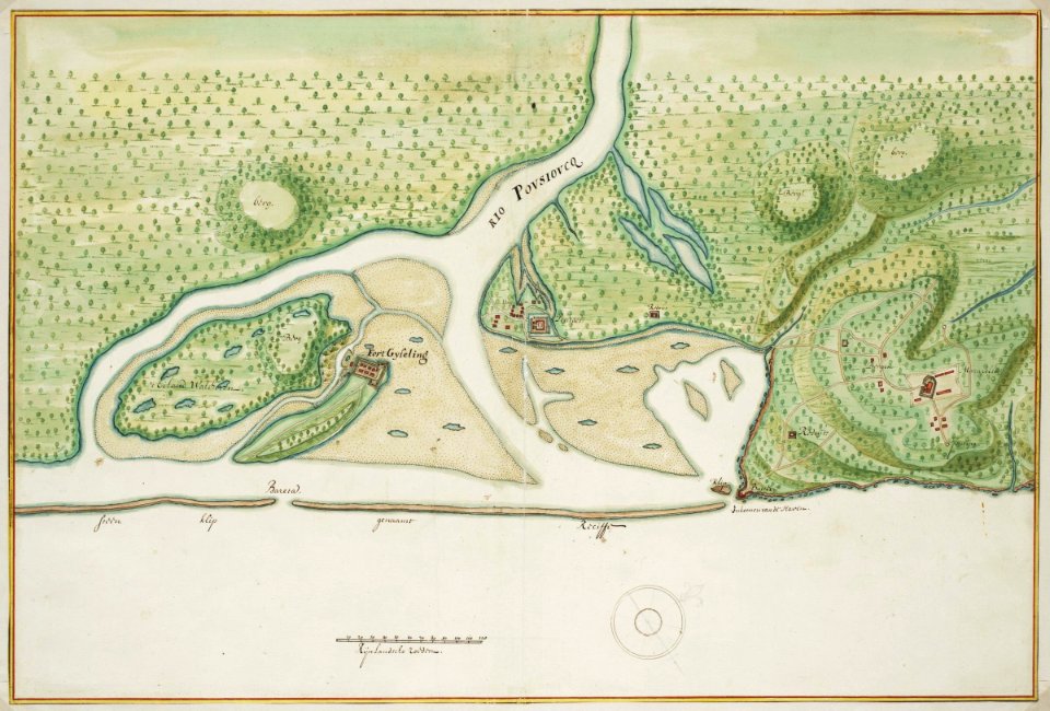
siege of steenwijk 1592
maps of steenwijk
gemeente atlas van nederland - south holland
1860s maps of south holland
media from atlas of mutual heritage on dutch east india company
1665
1640s maps of the tsardom of russia
17th-century maps of circassia
atlas geographico del reyno de españa e islas adjacentes (1757)
1757 maps of spain
gemeente atlas van nederland - south holland
1860s maps of south holland
gemeente atlas van nederland - north holland
19th-century maps of amsterdam
gemeente atlas van nederland - north holland
amsterdam in the 1860s
maps of the history of sweden
1386 in sweden
atlas van loon
1664 maps
atlas van der hagen (volume 4)
german renaissance
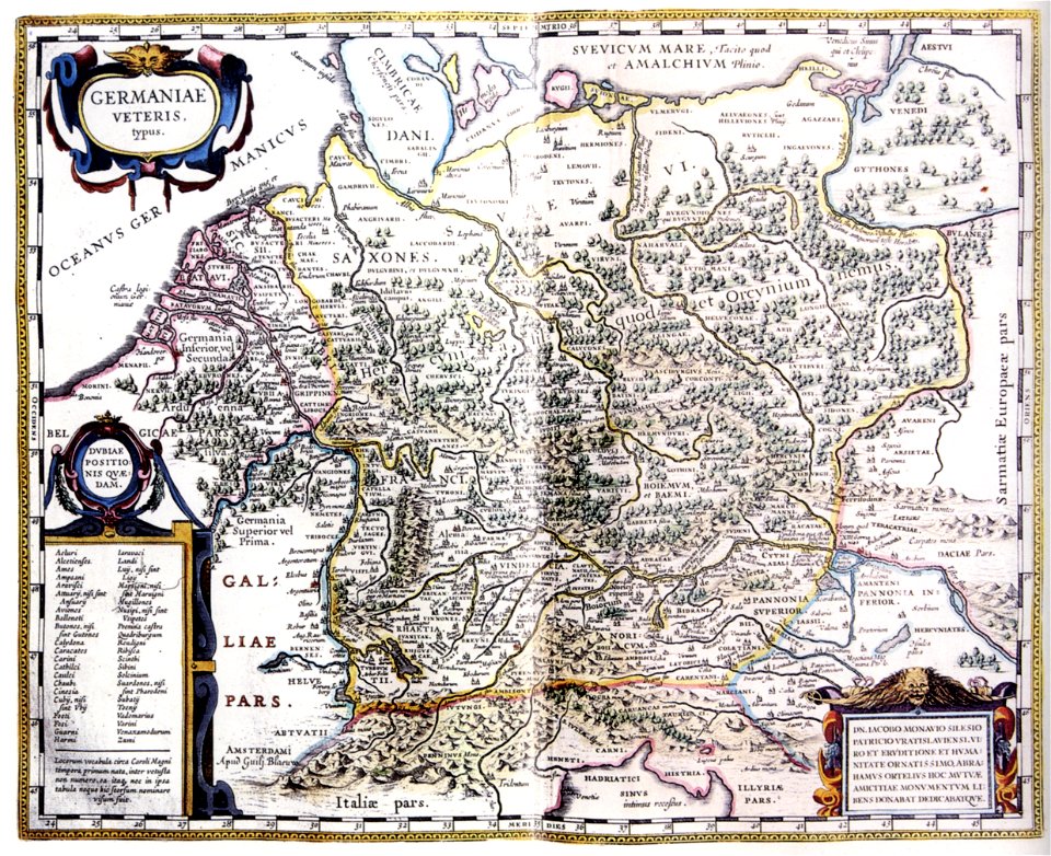
atlas maior, vol 3 (germany) - joan blaeu, 1667 - bl 114.h(star).3
johannes gigas
old maps of damme
atlas van loon
gemeente atlas van nederland - north holland
maps of diemen
gemeente atlas van nederland - north holland
maps of diemen
gemeente atlas van nederland - utrecht
old maps of amersfoort
maps of the west-indische compagnie
old maps of dutch brazil
russian empire in thomas kitchen's general atlas (1773)
general atlas (1773)
collections of prädikantenbibliothek isny
maps by willem and johannes blaeu
maps from university of amsterdam special collections
atlas der neederlanden
atlas schoemaker-zeeland
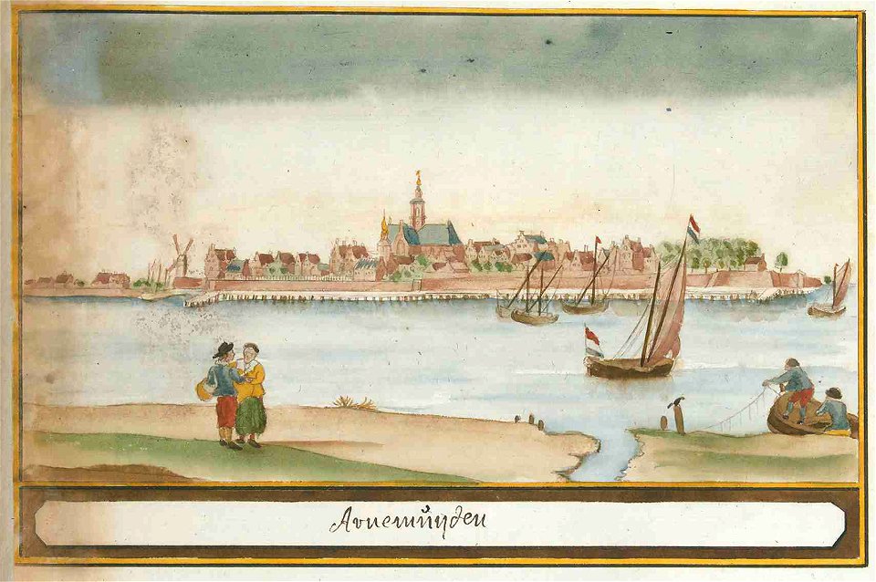
old maps of arnemuiden
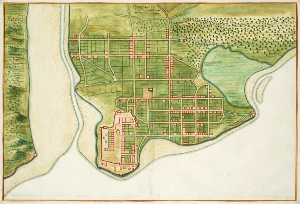
maps of ciudad colonial
1665
17th-century maps of south america
maps by nicolas sanson
atlas du canton de paris, 1795
plan de roussel
gemeente atlas van nederland - south holland
maps of oudewater
maps by willem and johannes blaeu
safavid dynasty
maps of the dutch east india company - india
1665
maps by willem and johannes blaeu
1662
atlas ou representation du monde universel t. 1 (1633)
1630s maps of the netherlands
gemeente atlas van nederland - south holland
strevelshoek
maps from university of amsterdam special collections
atlas der neederlanden
gemeente atlas van nederland - south holland
1860s maps of south holland
atlas minor gerardi mercatoris (1621, maps)
17th-century maps of siberia
gemeente atlas van nederland - north holland
maps of texel
maps of the west-indische compagnie
old maps of dutch brazil
maps of the umayyad caliphate (damascus)
old maps of the caliphate
gemeente atlas van nederland - south holland
maps of noordeloos
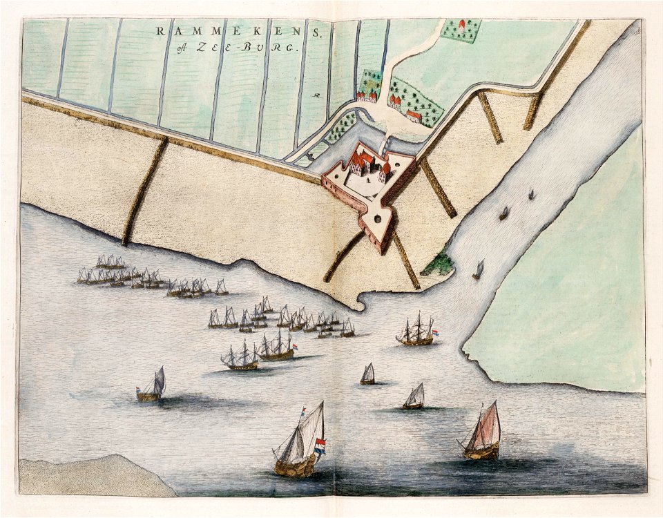
fort rammekens in art
1649 maps
maps by willem and johannes blaeu
atlas van loon
gemeente atlas van nederland - north holland
maps of amstelveen
maps of the ottoman empire by mercator-hondius
atlas van loon
damvillers
atlas minor gerardi mercatoris (1614, maps)
17th-century double hemisphere world maps
maps of steenbergen
fort henricus
17th-century maps of trinidad and tobago
animals on maps
roman catholic archdiocese of salzburg
old maps of salzburg (state)
maps by willem and johannes blaeu
old maps of swabia
17th-century maps of zeeland
old maps of south holland
atlas maior, vol 7 (france i) - joan blaeu, 1667 - bl 114.h(star).7
1667 maps
atlas maior, vol 4 (netherlands) - joan blaeu, 1667 - bl 114.h(star).4
1667 maps
atlas maior, vol 5 (england) - joan blaeu, 1667 - bl 114.h(star).5
17th-century maps of the isle of wight
atlas maior, vol 7 (france i) - joan blaeu, 1667 - bl 114.h(star).7
1667 maps
atlas maior, vol 9 (italy) - joan blaeu, 1667 - bl 114.h(star).9
1667 maps of italy
atlas maior, vol 9 (italy) - joan blaeu, 1667 - bl 114.h(star).9
1667 maps of italy
atlas maior, vol 12 (america) - joan blaeu, 1667 - bl 114.h(star).12
1667 maps
atlas maior, vol 5 (england) - joan blaeu, 1667 - bl 114.h(star).5
17th-century maps of england and wales
atlas maior, vol 6 (scotland and ireland) - joan blaeu, 1667 - bl 114.h(star).6
1667 maps
atlas maior, vol 9 (italy) - joan blaeu, 1667 - bl 114.h(star).9
1667 maps of italy
atlas maior, vol 4 (netherlands) - joan blaeu, 1667 - bl 114.h(star).4
1667 maps
atlas maior, vol 7 (france i) - joan blaeu, 1667 - bl 114.h(star).7
1667 maps
atlas maior, vol 9 (italy) - joan blaeu, 1667 - bl 114.h(star).9
1667 maps of italy
atlas maior, vol 9 (italy) - joan blaeu, 1667 - bl 114.h(star).9
1667 maps of italy
atlas maior, vol 8 (france ii and switzerland) - joan blaeu, 1667 - bl 114.h(star).8
1667 maps
atlas maior, vol 9 (italy) - joan blaeu, 1667 - bl 114.h(star).9
1667 maps of italy
atlas maior, vol 9 (italy) - joan blaeu, 1667 - bl 114.h(star).9
1667 maps of italy
801 - 900 of 4,774
Next page
/ 48